| Hello! Welcome to the world's most boring website! If you're interested in the latest shenanigans from me and my V-Strom 1000XT (aka: Big Bird), please head over to Instagram where you'll find me @TheNoddingBiker. My riding kit includes:
|
|
| Hello! Welcome to the world's most boring website! If you're interested in the latest shenanigans from me and my V-Strom 1000XT (aka: Big Bird), please head over to Instagram where you'll find me @TheNoddingBiker. My riding kit includes:
|
|
 If you have any questions about the maps on this website,
you can e-mail here:
If you have any questions about the maps on this website,
you can e-mail here:
![]()
This page is exists because I wanted to have an outlet for the free Garmin BaseCamp maps that I created.
FREE Garmin BaseCamp Maps
Colour-rich with road labels and easy identification of land features
Hill-shading with terrain data - showing height above sea-level next to Lat/Lon
Useful "areas/regions" with "touring-friendly" overlaps between Countries
These are available to download free and most maps cover additional areas around the main Country to allow for easy planning of trips/tours.
For instance, if you're doing a tour around Belgium and Calais is your arrival/departure port - you'll probably want an area like this. This gives you a good amount of surrounding area without having to use individual Country maps.
The maps have been compiled by myself using OpenStreetMap and DEM/Elevation data plus a considerable amount of work to tweak the visual theme; I wanted something better than the "generic-new" style offered by the (now offline) Dutch-based openstreetmap on-demand server and something resembling the excellent Freizetkarte maps.
With the emphasis on clear road identification (eg: highway "shields") along with colour-recognition it makes for a much easier process of identifying road-types, planning and improves the user experience (for me, anyway!). Most POIs render at the highest zoom-level, with petrol stations appearing a little earlier. Fuel stations can be searched for as can any Address/POI.
Road detail increases as you zoom in, and I have "tamed" a number of land features such as paths, ditches, nature areas etc. For best results, set the "Detail Level" in BaseCamp to "High" - although you may wish to increase this when navigating more remote areas.
As you move the mouse around, you'll notice that the elevation height is also display next to the Lat/Lon co-ordinates.
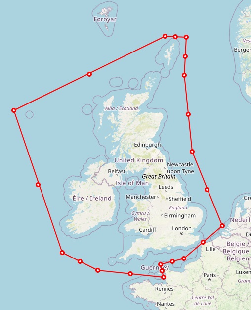
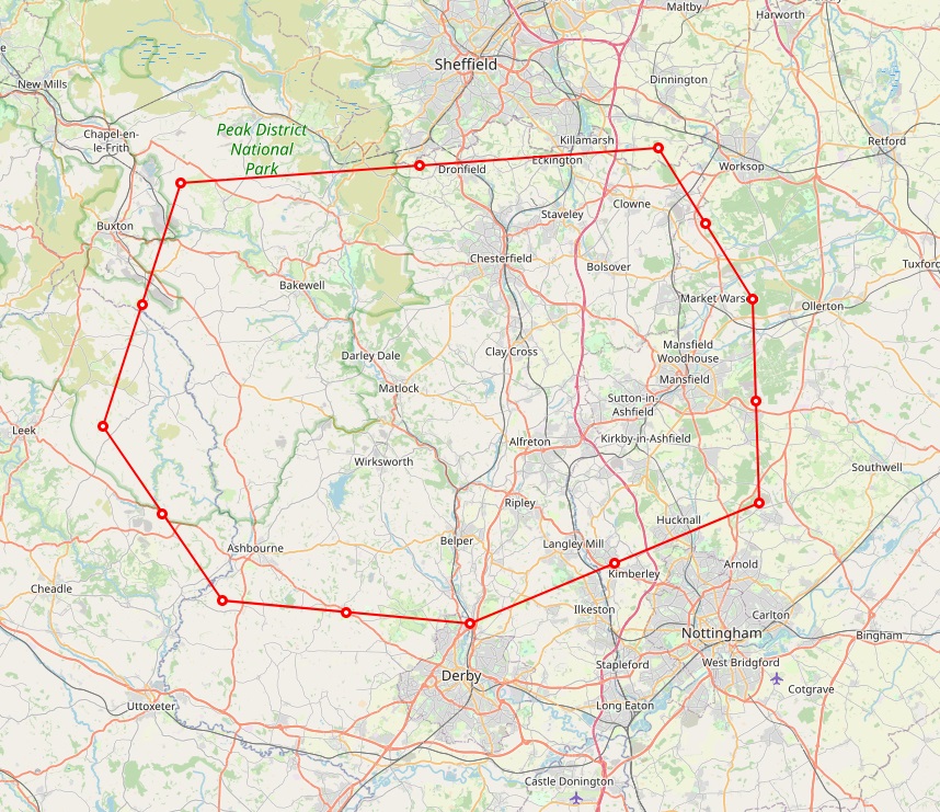
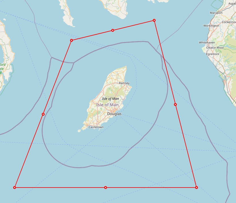
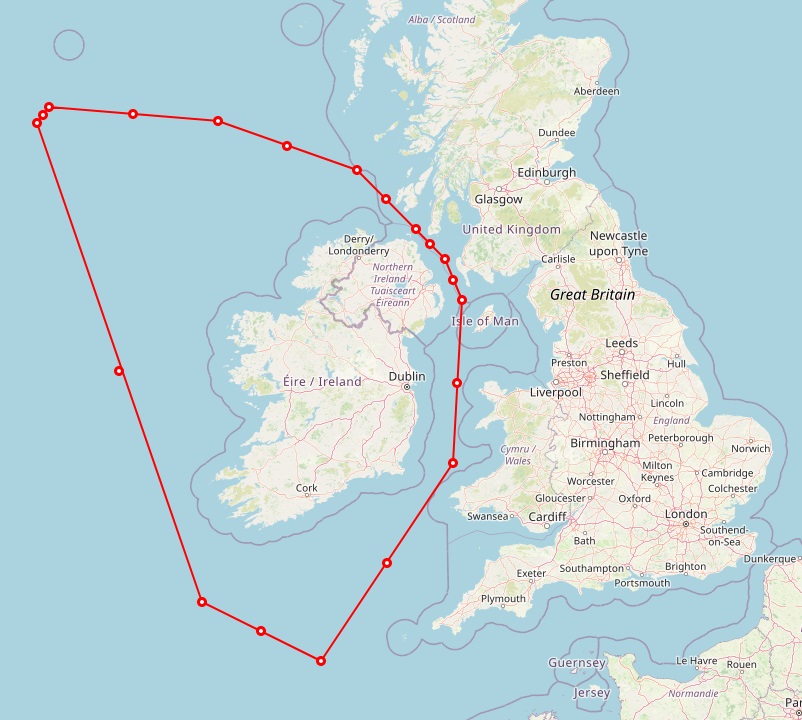
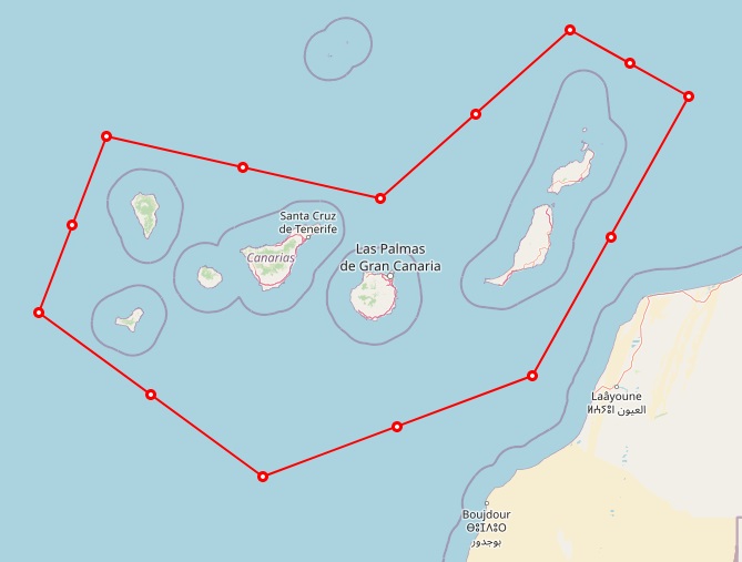
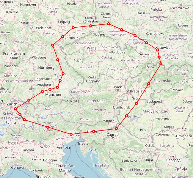
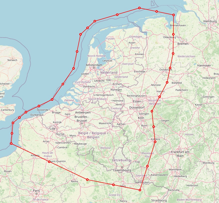
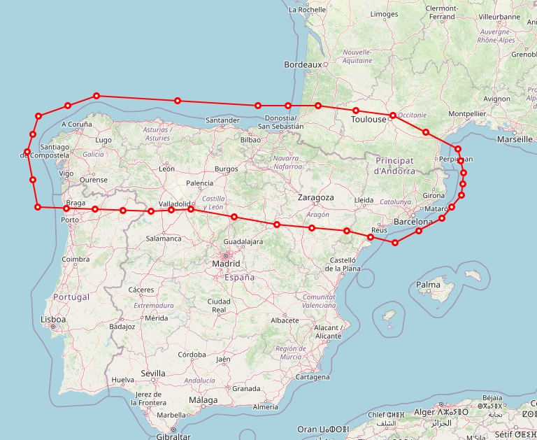
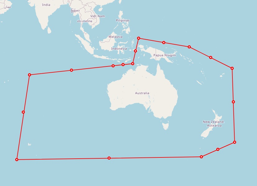
Example BaseCamp Maps - click for larger versions


These can co-exist with other OSM/Freizeitkarte maps and make for interesting comparisons when switching between different "themes".
I suggest trying the smaller Canary Islands, Essex Test, Isle of Man or Matlock-Derby maps to see what you think before getting the larger ones I update the maps every 4-6 weeks.
UPDATE 28th August : I am moving away from EXE installers to simple ZIP archives to allow Linux/Mac use.
These are for directly unzipping (or deleting!) into the C:\ProgramData\Garmin\Maps or equivalent on a Linux/Mac system
using WinRAR/WinZIP.
Free Garmin BaseCamp Maps (with hill-shading/terrain
data) for the UK, Europe and World:
IF YOU DO NOT CARE ABOUT HILL-SHADING/ELEVATION,
YOU CAN USE THE "BASIC" MAPS FURTHER DOWN
Basic (non-elevation) versions of above :
 BaseCamp Map of Canary Islands") These use the same style as the maps above but do not contain
the hill-shading/elevation data - this means that they are slightly smaller in
size but also a bit faster to display on your computer as the hill-shading can
be fairly CPU/graphics intensive, particularly in "hilly" areas.
These use the same style as the maps above but do not contain
the hill-shading/elevation data - this means that they are slightly smaller in
size but also a bit faster to display on your computer as the hill-shading can
be fairly CPU/graphics intensive, particularly in "hilly" areas.
On the right, click the image to see a comparison of the Canary Islands, or here's a view of the area near Santander, part of the "Picos" tour.
With these maps, any exported route will not contain elevation data. Some navigation apps calculate it as part of the routing, but if you are touring "hilly" places and need to know the terrain, the maps above would be better.
It is unlikely that I'll offer a full compliment of this type of map, but we'll see how the storage/bandwidth stats look during 2025!
Free Garmin BaseCamp
 Map of Ireland") OSM "generic" Maps
OSM "generic" Maps
Here are a few maps using the old "generic new" theme - I don't intend to make
any changes to them but they are up-to-date in terms of roads. As they do
not contain Elevation Data, they are smaller than my own maps and work a bit
faster on older machines.
These can co-exist alongside the standard maps above.
Custom Map Requests
Although it takes just a few minutes to "draw" a custom area and produce an
output template to "build" the map, the main issue is my computer CPU time so I
have no plans to offer any custom maps or an "on demand" facility.
New map areas of interest may be added over time.
Building a Map
The mapping data comes from OpenStreetMap in PBF format which is freely available from the
Geofabrik server. To build maps for Countries
(or specific areas) requires some knowledge of command-line tools such as
mkgmap/splitter and osmium plus a working Java environment. The mkgmap website
is a good place to start. Building a Garmin map (for either BaseCamp or a GPS IMG)
file is just 2 lines of code but includes several parameters to deal with the
map Name/ID plus how to handle the borders+sea area. Optionally, you can
merge DEM/Elevation files from
ViewFinderPanoramas or Bailu.ch for hill-shading and height info on the map.
I have wrote a batch file which stores a number of my favourite custom areas (hand-drawn "zones" using my online Polyfile creator) plus default countries - BaseCamp only handles 1 map at a time so for a tour into Europe, having a map that overlaps countries is very handy. Changing the colours/icons involves using a TYPEditor to manipulate the data inside a special file - there are also a series of "style" files that determine what TYP element (area, line/road, icon etc) to show at a given zoom-level. This allows you to leave POIs until "max-zoom", but have road-lines get thicker (and more detailed) as you zoom in.
There are also some annoying interesting
"features" with TYP files and objects that require you to adhere to certain
"rules" or you end up chasing non-existent bugs!
BaseCamp Tips/Tricks
One of the nice feature of BaseCamp is that you can create Folders and Lists to
group Routes, Tracks and Waypoints - perhaps England, Scotland, Wales, France,
Spain etc.
A problem then arises when you wish to plan a Route in a new "List" which means you don't have any existing Waypoints visible.
 My
solution is to create a separate Folder and inside place a List called All
Waypoints. This also allows me to "select all" items and export to my
phone's navigation app. When you are planning a new route - create it
inside this Waypoint List so that all your Waypoints are visible (but no
other Routes). All
your new Routes can be created here, so long as they don't overlap each other.
My
solution is to create a separate Folder and inside place a List called All
Waypoints. This also allows me to "select all" items and export to my
phone's navigation app. When you are planning a new route - create it
inside this Waypoint List so that all your Waypoints are visible (but no
other Routes). All
your new Routes can be created here, so long as they don't overlap each other.
When you have a completed the Route, just copy+paste it into your existing filing system: Any Waypoints within the Route will also be copied into the List. You can then right-click the Route in the All Waypoints List and select "Remove" - this still leaves it in the normal Route List.
If you ever get into a pickle with duplicates and inadvertently create an "orphan" item, it can be found in the Unlisted Data folder at the bottom of the tree.
